

Learn
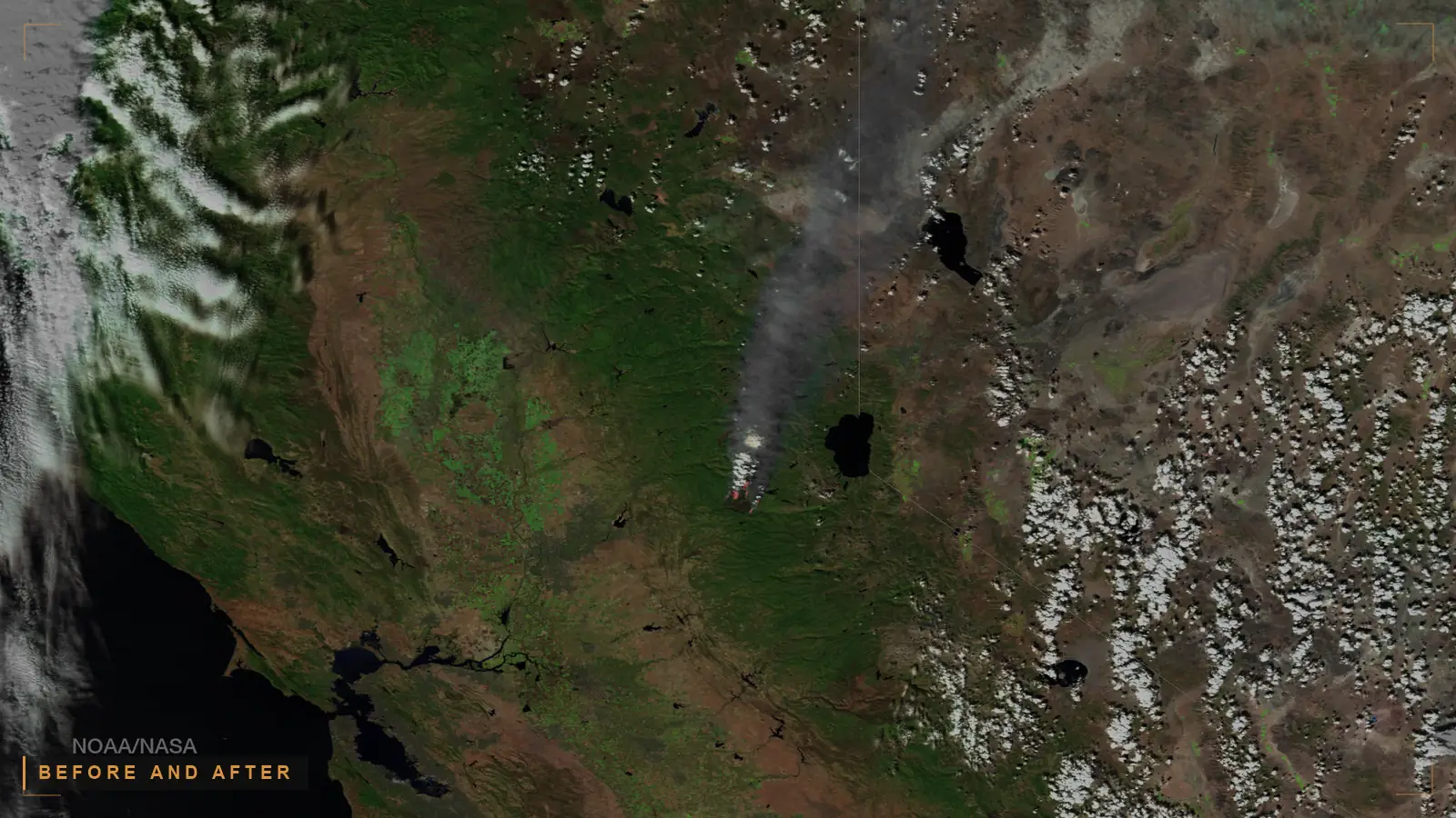
Change detection is the remote sensing process of comparing imagery of the same geographic area acquired at different times to identify and quantify what has changed on the ground, such as new construction, movement, or activity.
Last updated: October 23, 2026
Why it matters to your mission. A single satellite image tells you what a place looks like. Two images of the same place over time tell you what is happening there. Change detection is the discipline of finding those differences at scale: the new building, the vehicle that was not there yesterday, the pattern of activity at a site under watch. The hard part is not spotting a different pixel. It is deciding which differences are meaningful, and a detected change on its own is only an indicator. It becomes intelligence when it is fused with other sources and set against the normal pattern of life for that place.
Change detection is the remote sensing process of comparing imagery of the same geographic area acquired at different times to identify and quantify what has changed on the ground, such as new construction, movement, or activity. It is one of the foundational techniques of Earth observation, and it rests on a simple premise: the differences between two co-registered images of a place reveal how that place changed between the two acquisition dates.
The National Geospatial-Intelligence Agency (NGA) defines it the same way in doctrinal terms: change detection is "the comparison of multiple images collected for one area at different times, to determine the type, magnitude and location of change," derived from "either aerial or satellite imagery" (NGA, Changing the Perception of Change Detection). The peer-reviewed remote sensing literature agrees. A 2023 comprehensive review describes change detection as the task of, given two or more remotely sensed images of the same area captured at different times, identifying changes in the land surface "by comparing the pixel values of the images and applying appropriate change detection algorithms" (Change Detection Methods for Remote Sensing in the Last Decade, arXiv 2305.05813). The underlying signal is physical: the method works because there is a "difference in reflectance or intensity values between the images taken at two different times due to changes on the Earth's surface." The output is usually a per-pixel label marking each location as changed or unchanged.
Key takeaways
Change detection works by aligning two or more images of the same place and measuring where they differ. The workflow is consistent across methods. First, the images are radiometrically and geometrically prepared so that differences in the data reflect differences on the ground rather than differences in how the images were captured. Second, the images are co-registered so that the same ground location sits at the same pixel position in every image. Third, a comparison algorithm produces a change map, and finally that map is interpreted and validated.
Co-registration is not a formality. The remote sensing literature is explicit that "a typical requirement for change detection from remote sensing images is the accurate registration of temporal images," and that "any registration errors present in the images may lead to incorrect change detection" (arXiv 2305.05813). A misalignment of a few pixels along a coastline or a building edge will be reported as change even though nothing on the ground moved. This is the first reason a detected change is only a candidate: some of what a naive comparison flags is an artifact of the imagery, not an event in the world.
NASA's Applied Remote Sensing Training program (ARSET) teaches the two most common entry points to the technique. In its Change Detection for Land Cover Mapping training, "attendees learned change detection methods including image subtraction and classification" (NASA Earthdata ARSET). Image subtraction, also called image differencing, compares the two dates directly. Classification compares the land-cover labels assigned to each date and reports where the class changed. Both are standard, and both produce a change map that still has to be read by an analyst or a downstream system.
Change detection methods are usually grouped by the unit of analysis they operate on. The foundational survey in this area, Hussain et al. (2013), organized the field along exactly this axis, contrasting pixel-based detectors with object-based change detection and arguing that object-based methods are better suited to very-high-resolution imagery, where per-pixel detectors produce noisy results (Hussain et al., ISPRS Journal of Photogrammetry and Remote Sensing). More recent reviews add deep learning as a third broad family and a scene level above the object.
| Method family | Unit of analysis | How it decides a change | Strength | Main limitation |
|---|---|---|---|---|
| Pixel-based (e.g. image differencing, ratioing, PCA, change vector analysis) | The individual pixel | Compares pixel values directly between dates and thresholds the difference | Simple, fast, well understood, no training data required | Salt-and-pepper noise; sensitive to misregistration and lighting |
| Object-based (OBIA) | A segmented ground object or region | Compares the features of segmented objects across dates | Reduces noise, adds spatial and edge context, suits high-resolution imagery | Depends on segmentation quality; more computationally involved |
| Deep learning (e.g. Siamese CNNs, transformers) | Learned features over pixels and regions | Learns to distinguish real change from nuisance change from labeled examples | High accuracy on complex scenes; learns context automatically | Needs large labeled datasets; can be opaque to inspect |
| Scene-level | A whole image tile or region | Classifies the overall change state of a large area | Efficient for broad-area monitoring | Coarse; does not localize the change precisely |
Pixel-based methods are the classic toolkit; the literature lists the common algorithms as "image differencing, image ratioing, image regression, principal component analysis (PCA), and change vector analysis" (survey summary). Their known weakness is the salt-and-pepper artifact, where independently classified neighboring pixels disagree under noise. Object-based analysis fixes this by making the segment, not the pixel, the unit of classification. Deep learning methods, now the most active research area, learn the distinction between meaningful and nuisance change from labeled data, which is powerful but shifts the burden onto dataset quality and makes the reasoning harder to inspect.
Change detection uses two main families of imagery, and the choice between them is a choice about what you can see and when. Electro-optical (EO) imagery is passive: the sensor records reflected sunlight, so it produces a picture close to what a person would see from above, but it needs daylight and clear skies. Synthetic aperture radar (SAR) is active: the sensor emits its own energy and measures the return, so it works day or night and sees through cloud and smoke.
NASA Earthdata draws the same active-versus-passive line: "active instruments emit energy and collect data based on changes in the return signal," while "passive instruments detect energy emitted from the natural environment" (NASA Earthdata, Remote Sensing). SAR is particularly well matched to change detection. NASA describes it as a technology that, "over time, can detect even minute changes on Earth's surface" (NASA Earthdata). Because SAR responds to structure, roughness, and moisture rather than color, it is strong at detecting new construction, disturbed ground, flooding, and other physical changes that EO might miss under cloud or at night.
| Imagery type | Sensing | Best for | Constraint |
|---|---|---|---|
| Electro-optical (EO) | Passive, reflected sunlight | Visual interpretation, land cover, construction, human-readable change | Needs daylight and clear skies |
| Synthetic aperture radar (SAR) | Active, emitted radar | All-weather, day or night, structural and surface change | Imagery requires specialist interpretation |
The two are complementary. A mature change detection capability does not pick one; it reasons across EO and SAR together, along with ancillary geospatial layers, so that a change seen in one is corroborated or explained by the other. That cross-source reasoning is where change detection starts to look less like image processing and more like an intelligence problem, which is the subject of the pattern-of-life and fusion sections below. For the broader discipline that turns imagery into assessed intelligence, see what is GEOINT.
Classic change detection compares two dates. The field has been moving steadily toward continuous monitoring of dense image time series instead. The U.S. Geological Survey frames this as a shift away from "change detection, typically using two points in time" toward time series analysis that "is expanding the kinds of land surface change that can be monitored," noting that "dense time series analysis is providing new information on the timing of landscape changes" (USGS, Transitioning from change detection to monitoring).
The distinction matters for intelligence use. A two-date comparison tells you something is different now versus then. A monitored time series tells you when the change began, how fast it is progressing, and whether it is a one-time event or a recurring pattern. That temporal context is what separates a change from an understood change. It is also what makes change detection a data problem at scale: monitoring a large area continuously means ingesting, aligning, and comparing far more imagery than any two-date workflow, and doing it fast enough that the result is still timely when it reaches a decision-maker.
A detected change is an indicator. It tells you that something at a location is different, but not what it means, whether it matters, or whether it is even real rather than an artifact of lighting, season, or misregistration. Turning that indicator into intelligence requires two things the imagery alone cannot supply: corroboration from other sources, and the context of what is normal for that place.
Corroboration is the job of fusion. A new structure detected in EO imagery means more when SAR confirms recent ground disturbance, when a signals or logistics source places activity there, and when open-source reporting aligns in time. No single feed is conclusive; the assessment lives in the correlation across them. This is the same discipline described in multi-INT fusion, applied to imagery-derived change as one input among many.
Context is the job of pattern-of-life analysis. A convoy at a depot is routine if that depot sees convoys every week and significant if it has been quiet for a month. Change detection measures the difference; it cannot tell you which difference is a deviation from the baseline without a model of the baseline. That is precisely what pattern-of-life analysis and activity-based intelligence provide: the established rhythm of a place against which a new observation is judged either normal or anomalous. NGA doctrine draws the same line between the pixel and the meaning, treating "change detection (understanding changes) and resulting track extraction (understanding activities)" as distinct steps, where persistent change over time is what lets an analyst derive the movement and activity behind the change (NGA).
This is why change detection, done seriously, is a reasoning problem and not only a pixel-difference problem. The pixel difference is the cheap part. The expensive part is relating that difference to every other thing known about the location, resolving which records describe the same activity, and presenting the result so an analyst can trace it back to its sources. Delivering this at the tempo of a standing collection mission is the work of AI-enabled ISR and PED, where change detection is one trigger in a larger processing, exploitation, and dissemination flow.

A pixel difference is a candidate, not a conclusion
Change detection aligns images of the same place and measures where they differ. Misregistration, lighting, and season all create apparent change, so the change map is only a candidate.
A new structure in EO imagery means more when SAR confirms ground disturbance and other sources align in time, and a convoy matters only against the normal rhythm of that site.
The core challenge of change detection is distinguishing real, meaningful change from the much larger volume of apparent change that does not matter. Several well-documented failure modes drive this.
The first three are image-processing problems that better methods have largely tamed. The last two are intelligence problems. They are not solved by a more accurate change map; they are solved by reasoning over the change in context, which is where the data infrastructure underneath the analysis determines whether the capability is useful or merely noisy.
Torch.AI does not build an imagery change detection algorithm, and this page is not a claim to one. What Torch.AI builds is the government-owned reasoning infrastructure that turns a detected change from an isolated indicator into an assessment an analyst can trust and trace. The pixel comparison is upstream. The problem Torch.AI addresses is everything that has to happen after a change is flagged for it to mean something.
That work is correlation under provenance. A change observed in imagery has to be related to other sources, matched against the pattern of life for that location, and resolved against records that may describe the same activity in different systems and formats, all without losing the thread back to the authoritative source. ORCUS provides the data-availability layer that connects to those sources and preserves provenance. NEXUS applies semantic representation so unstructured records and reports become something a system can correlate with an imagery-derived change. HALO fuses the resolved entities and relationships into a graph an analyst can inspect, showing how a change connects to everything else known about a place. Because this runs as a system of reason on top of existing systems of record, the imagery archives and analytic tools stay in place, and in a government-owned deployment the customer keeps control of the layer where a change becomes understanding. You can see how this is packaged on the Torch.AI software page.
For evaluators, the fit is specific: if your change detection output is a stream of indicators arriving faster than anyone can corroborate, contextualize, and act on them, that is a data and reasoning problem, and it is the one this infrastructure is built for. Request a technical walkthrough and we will run it against a representative slice of your own multi-source data, with provenance traced end to end.
The detection algorithm is one input. If you are evaluating the infrastructure that makes change detection output usable as intelligence, require:
Evaluating a capability? Bring these six requirements to a scoping call and we will walk each one against your environment: request a technical walkthrough.
Change detection works by aligning two or more images of the same place taken at different times and measuring where they differ. The images are first radiometrically prepared and co-registered so the same ground location sits at the same pixel in each image, then a comparison algorithm produces a change map. Accurate registration is essential, because alignment errors are reported as change even when nothing on the ground moved.
The main families are pixel-based methods such as image differencing, ratioing, principal component analysis, and change vector analysis; object-based methods that compare segmented ground objects; and deep learning methods such as Siamese networks and transformers that learn to distinguish real change from nuisance change. Object-based and deep learning approaches reduce the salt-and-pepper noise that affects per-pixel methods and suit very-high-resolution imagery.
Change detection uses electro-optical (EO) imagery, which is passive and records reflected sunlight, and synthetic aperture radar (SAR), which is active and emits its own energy. EO produces human-readable pictures but needs daylight and clear skies; SAR works day or night and through cloud, and NASA describes it as able to detect even minute changes on Earth's surface over time. Mature workflows use both together.
The central challenge is distinguishing meaningful change from apparent change caused by misregistration, seasonal and lighting variation, and sensor noise. Beyond image-processing difficulties, most detected change is irrelevant, so the harder problem is prioritizing the few changes that matter against a flood that do not, and doing so at the scale and tempo of continuous wide-area monitoring.
A detected change is an indicator, not a conclusion. It tells you something is different but not what it means or whether it matters. Fusion with other sources corroborates the change, and pattern-of-life context judges it against what is normal for that location. Change detection measures difference; it becomes intelligence only when that difference is correlated with other sources and interpreted against an established baseline.


Describe the problem.
Define the constraints. We will structure the session.
No demo.
No slide deck.
Real work.
Describe the indicators piling up. We will scope a session that corroborates and contextualizes change against your data. No pixel demo. Your multi-source data. Real work.